 |
| Fishing Bridge over the Yellowstone River, 1920s |
INTRODUCTION
|
Bridges and river causeways have been an integral part of Yellowstone’s history since 1871 when Jack Baronett built the first known bridge in Yellowstone near the current Tower Junction. Due to the rugged wilderness conditions of early travel in the first decade of the Park’s official establishment (1872-1882), journeys were of necessity limited to horseback, pack trains and foot travel. When Philetus Norris became Yellowstone’s 2nd Superintendent in 1877, existing roads, crude at best, totaled about 32 miles with approximately 108 miles of trails. He began an extensive campaign of road and bridge building that continued until his departure in 1882. The roads were admittedly crude and were described by many as only "fair" wagon trails. Nonetheless, they still provided improved access to the many wonders of Yellowstone. By the time he left there were five times as many roads and twice as many trails. He also constructed countless bridges, including several on Cascade Creek, the forks of the Gardiner, Firehole and Gibbon rivers, Crystal Falls at Canyon and others. Regardless, fording streams was still quite common during those years. Succeeding superintendents continued bridge and road building and improvements/repairs.
|
 |
|
In 1883 the roads had improved enough that the Wakefield & Hoffman Stage Co. began running tourist stages from the NPRR depot at Cinnabar, Mt to Mammoth Hot Springs, Norris, Old Faithful and Canyon. The Yellowstone Transportation Company took over the stage lines in 1886 and sub-leased the actual stage operations to Wakefield & Hoffman. Coach service was extended to Lake from Canyon and after 1891 the road opened from Old Faithful to West Thumb and Lake Hotel.
|
 |
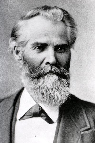
On March 3, 1883, the first phase of military presence began in Yellowstone. The Army Corps of Engineers arrived to take charge of the construction and improvements to the Park's road system. Three years later, the U. S. Cavalry would join the Engineers and assume the role of administrating the Park. In August, 1883, 1st Lt. Dan C. Kingman, U.S. Army Corps of Engineers, escorted by members of the 6th Infantry, arrived at the Mammoth Hot Springs headquarters. He began establishing the first official road and bridge standards for the park and continued his work until 1890. Some of his bridge accomplishments include the 1st trestle bridge through Golden Gate canyon and the 2nd wooden bridge over Crystal Falls.
|
|
In 1891 Hiram M. Chittenden of the Army Corps of Engineers took over road construction until 1892, returning in 1899 and serving until 1906. Some of his major works included the Melan Arch at Canyon (Chittenden Bridge), the 2nd Golden Gate viaduct, road and spiral bridge over Sylvan Pass, Fishing Bridge and the Roosevelt Arch at the North entrance. Improvement continued through the years and even today it remains a challenge to keep up with the ever-increasing traffic and wear & tear.
Photos for this section courtesy the NPS. For additional information on the bridges and roads in Yellowstone, please refer to the sources listed at the bottom of the page.
|
 |
Although there are and have been many countless numbers of bridges in Yellowstone, I have selcted the following that I thought of historical interest - some still in use, some in existance but no longer utilized, and some that have been removed from the landscape.
TOWER AREA |
W.H. Jackson photo 1871, #187114836 |
Baronett Bridge
Built in the spring of 1871 by Collins Jack Baronett, his bridge is believed to be the first bridge built across the Yellowstone River. (Sometimes spelled Baronette, “Yellowstone Jack” also went by John H. Baronett.) Gone for over 100 years now, the bridge was located about 200 yards upstream from where the Lamar River empties into the Yellowstone. It was built as a toll bridge for the miners, hunters, and freighters traveling to the mines of Cooke City. The operation, including Baronett’s nearby cabin & outbuildings cost about $4,000.
|
Baronett Bridge Real Photo, ca1880s |
|
During the Nez Perce war of 1877, much of the log work was burned. Baronett and P.W. Norris partially rebuilt the bridge in the following year. During much of this period of time Baronett was off on many gold prospecting expeditions in various parts of the West, and partners John Ponsford and J.L. Sanborn operated the toll bridge for him. In 1880 Baronett replaced the stringers, floor braces, and iron work at a cost of $2,000. In the early 1890s the government later refused to issue him a permit to continue operating the bridge and the Army summarily took possession of the structure in 1894. It continued to be used until a new bridge was constructed upstream in 1903. The old bridge was finally burned around 1906 and torn down in 1911. After a prolonged and expensive legal battle, Baronett received $5,000 from the government for his bridge. Traces of the old Baronett Bridge remain today, along with the old road into Yancey’s Hole.
|
|
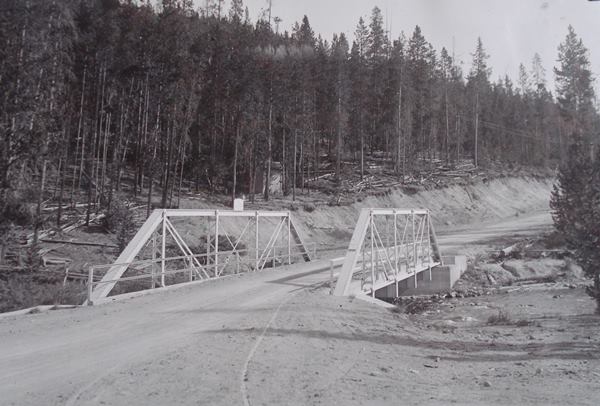
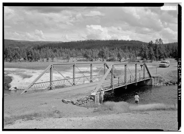
Tower Junction Bridge
In 1903, a new and much larger bridge was constructed over the Yellowstone River near the current Tower Junction. Located farther upstream, the new “Tower Bridge” replaced Baronett's bridge. The 130’ steel deck truss bridge was completed in the spring and designed by the American Bridge Co. At the time, it was considered the longest single-span steel bridge in the park. Fifty years later in 1963, the Tower Bridge was replaced and widened with a 604’ bridge at a cost of $435,000.
Modern Day Postcard, Author's Collection
|
 |
CANYON AREA
|
Cascade Canyon – Crystal Falls Bridges
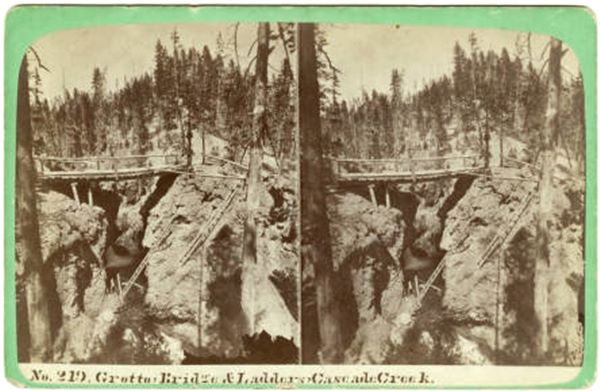
The Crystal Falls wooden bridge was built over Cascade Creek and Crystal Falls in 1880 by Supt. Philetus Norris. At some point in time, the bridge was improved & rebuilt. In an 1889 report to the Secretary of War, Major Allen noted there was a 40' single-span King and Queen post-truss bridge with a trestle approach of 30’ that spanned Cascade Creek. Its height above low water was 20'. At some point prior to 1889 wooden ladders were placed to provide access to Grotto Pool, below the bridge. They were reported to be in use as late as 1916.
|
 |
Late 1800s stereoview depicting Crystal Falls
and the wooden ladders reaching down to Grotto Pool
|
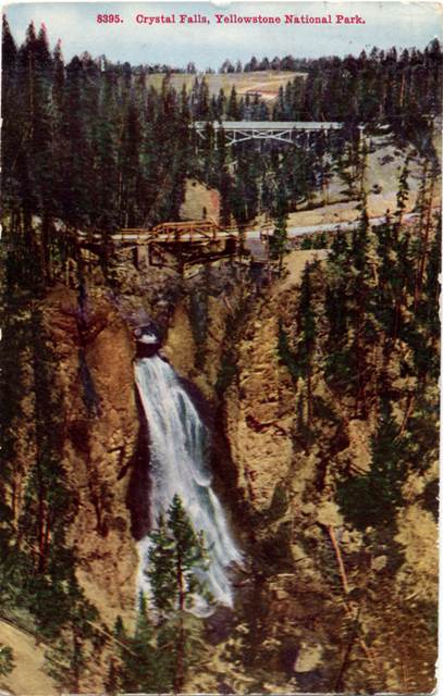
Postcard with Crystal Falls with the 2nd wooden bridge and Cascade Creek steel bridge upstream.
Tammen PC #8395 |
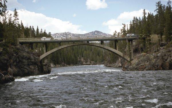
In 1903-04, the steel arch Cascade Creek Bridge was erected farther upstream to replace the Crystal Falls Bridge. It had a 120’ span with approximately 60’ approaches on either side and sat about 80’ above the creek bed. This bridge over Cascade Creek eliminated two bad hills and sections of road where sliding clay slopes made it extremely difficult to maintain a road. The junction of the Norris and Lake roads were changed to conform to the new road over Cascade Creek. The new road from the bridge passed through the middle of the Wylie Camp, which was moved to an area near the current entryway to the Upper Falls parking lot. After WWII an earth-filled causeway was built a short ways upstream (current location) and replaced the old bridge.
Cascade Creek Bridge, Haynes Photo ca1917 |
 |
 |
Unnamed Creek Bridge.
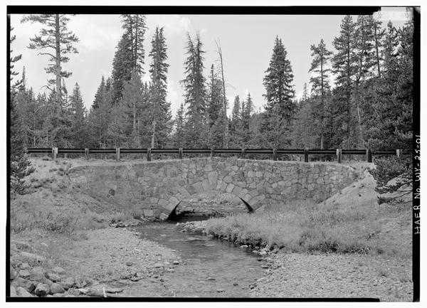
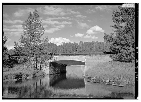
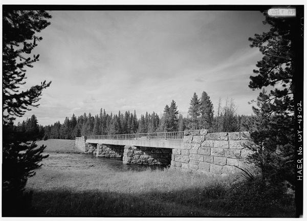
Along the road from Upper Falls to the Soldier Station, a bridge was constructed in 1880 over an unnamed tributary of Cascade Creek. In 1889 a trestle bridge, 14’ wide and 115’ long replaced the earlier bridge. The bridge was replaced in 1914 with a steel reinforced concrete culvert and is still in use today.
|
|
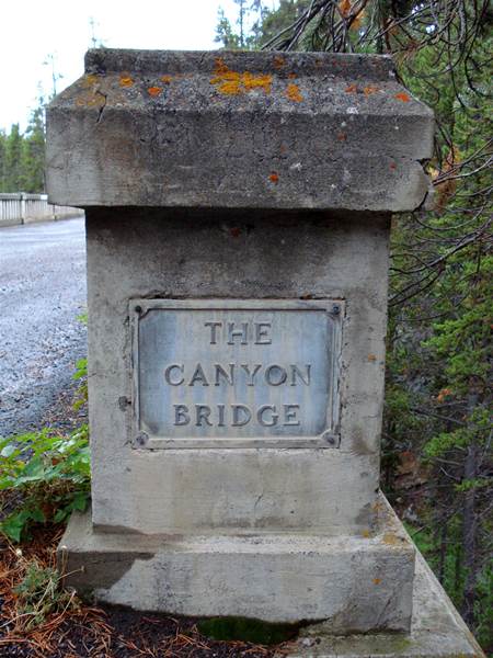
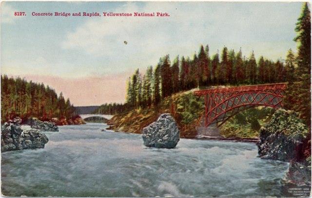
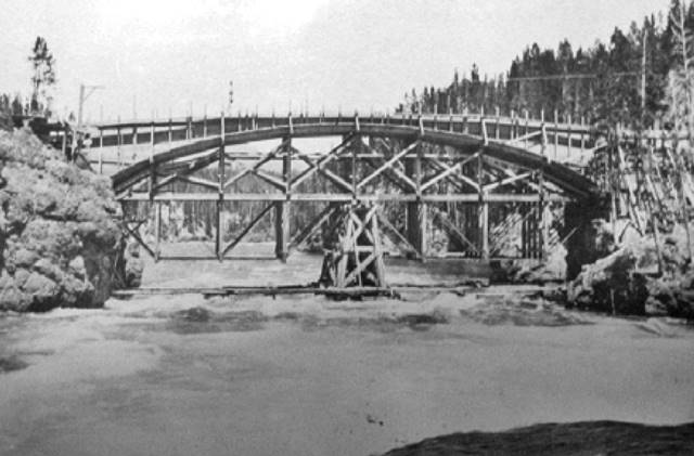
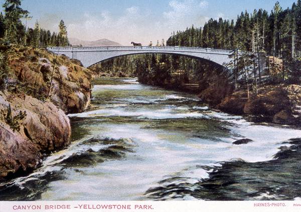
Canyon Bridge at Jay Creek
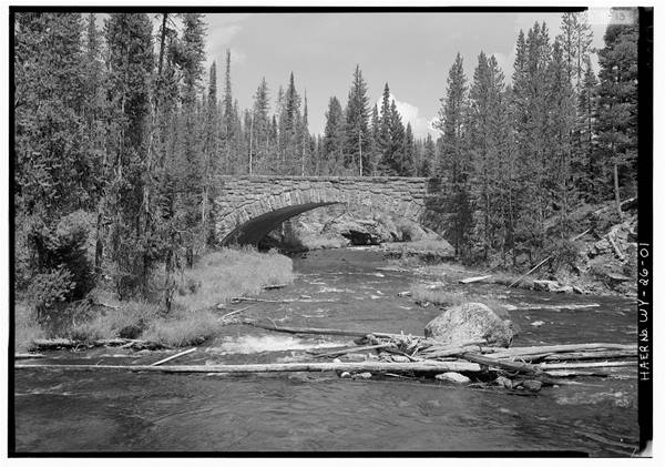
The 1st Canyon Bridge, constructed between 1893 and 1894, was a wooden arch truss bridge and the largest bridge built in the park at that time. The bridge, crossing Jay Creek near its mouth at the Yellowstone River, consumed half of the 1893 park appropriations budget and was finally completed in 1895.
It was replaced by the 2nd Canyon Bridge, built in 1914 under contract by the Army Corps of Engineers. This new bridge was a reinforced concrete rib arch design with open spandrels, 210’ long and supported by a 145-foot arch. It opened to the public on June 16, 1915, and still exists today for foot/bike travel.
Canyon Bridge Plaque 2007, Author Photo
|
 |
 |
Jay Creek Bridge - Steel, Tammen PC #8127
1912 Topo Map with Canyon Bridge Sites |

Jay Creek Bridge - Concrete, Tammen PC #4274
|
Chittenden Melan Arch - Canyon
Chittenden Bridge Construction 1903, NPS
|
Chittenden Bridge, Haynes PC ca1915
|
Chittenden Bridge, Haynes PC #17054
|
|
Hiram M. Chittenden of the Army Corps of Engineers, built a bridge over the Yellowstone River in 1903, just upriver from Upper Falls, so that tourists could safely visit the South Rim of the Grand Canyon. It was constructed out of concrete using a Melan Arch design. It was the second bridge built over the Yellowstone River, the first being Baronett’s Bridge at Tower.
“The exact form was a matter of careful study in order to get the lines which would appeal to the eye as meeting the artistic requirements. The span of the bridge is 120 feet and the rise of the arch is 15 feet. The height of the roadway at the center is 43 feet above low water in the river. The abutments are natural rock. The arch contains ten steel girders, which give it great strength. The body of the structure is solid concrete. The forms for the ornamental railing were manufactured in St. Paul, but the railing itself was molded in rich Portland cement mortar in place.” [Hiram Chittenden, 1915]
The completed structure, a graceful arch over the rapids, had a 120' span with a total length of 160'. The rise of the steel arch girders at the center of the bridge was 15'. The bridge surface also had an arched form, with the center 2'-6" higher than the ends. The center point of the roadway was approximately 43' above low water. The structure's full width was 18'-6" with the roadway itself 14'-6" wide. The design included a narrow walkway on either side, with an iron guard rail between the walks and the roadway. [HAER]
|
|
Chittenden Memorial Bridge
By 1960 time had taken its toll on Chittenden's 1903 bridge and an inspection deemed the structure unsafe. It was closed to the public immediately and plans were made to replace the bridge. A more modern design eliminated the visibility hazard created by the arched road surface in the Melan Arch design. Drivers of modern cars sat much lower inside the vehicle than drivers of stagecoaches or early model automobiles. Demolition of the old bridge and construction of a new bridge on the same site began in 1961. The new bridge, called the Chittenden Memorial Bridge, was completed in 1963. [Diane Papineau Canyon Village Thesis, 2008]
Chittenden Bridge 1994, NPS Jim Peaco
|
 |
LAKE - SYLVAN PASS AREA
|
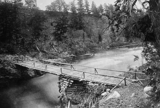
Corkscrew Bridge - Sylvan Pass
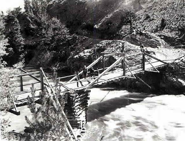
This term describes wooden bridges that were built to pass over themselves in order to avoid steep inclines on mountain passes. The wooden Corkscrew Bridge, also known as the Spiral Bridge, was built on Sylvan Pass in 1905. The bridge was improved in 1917, with a new 60-foot timber trestle and rock fill at the abutments.
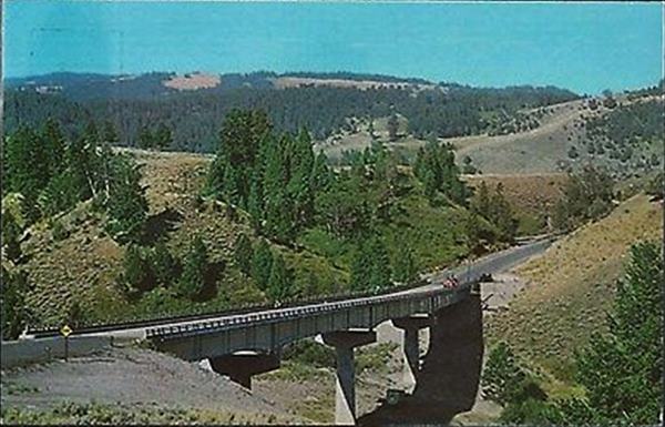
In 1919, the wooden trestle was replaced with a concrete arch/tunnel. By 1929, the bridge was bypassed by a new road constructed along the cliffs on the slopes above. The increasing power and speed of automobiles had rendered the spiral design obsolete. No doubtt the new road also eliminated much snow removal from the road in the bottom of the canyon. The bridge remains in the bottom of the canyon just east of Avalanche Pass and can be seen from a viewpoint along the present road. The bridge is still in remarkably good condition after all these years.
|
 |
 |
 |
| "Tex" Holm Camping tour on wooden Spiral Bridge ca1915. Tammen PC #1698 |
Spiral Bridge after concrete tunnel and rock fill installed, ca1920s. NPS
|
Spiral Bridge in 2007, viewed from main Cody Road. Author photo.
|
|
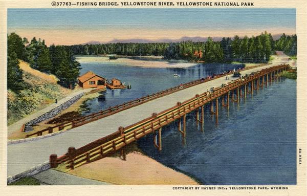
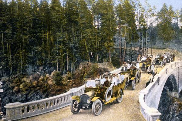
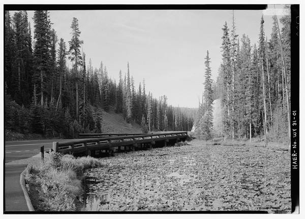
Fishing Bridge
This bridge, designed by Hiram Chittenden, was built over the Yellowstone River near its head at Yellowstone Lake in 1902. The name Fishing Bridge was officially affixed to it in 1914. Rebuilt in 1919, the bridge featured walkways on each side of the roadway. According to Hiram Chittenden, the 1902 bridge was “built on piles in 16-foot bents; total length 360 feet. In order to avoid a heavy embankment on the eastern approach to the bridge, yet, at the same time, to give rowboats ample space to pass under it at high water, the bridge was given a curved profile, so as to raise the center about 3 feet above the ends.” The bridge reached directly across the river at right angles to the shorelines.
In 1927 a boathouse with floating dock, office, and sleeping quarters was built at Fishing Bridge. The structure may have been mobile, attached to the bridge itself, and moored in different locations over the years. This first boathouse and dock served until 1935, when a much grander facility was constructed. Architect Robert Reamer designed this new 26’ x 54’ boat house, and it continued in service until 1963.
The old Fishing Bridge was replaced in 1936-37. According to Supt Rogers, the new bridge was, “. . . 532 feet in length consisting of 19-28 foot spans, cost approximately$100,000 or about $188 per lineal foot. It furnished a 24-foot roadway with the two 5-foot sidewalks and an overall width of 42 feet. The entire contract including the parking areas and supplemental work totaled about $140,000.” Fishing from "Fishing Bridge" was officially prohibited after the 1973 season.
|
|
 |
 |
| Fishing Bridge 1920s, YNP #171144 |
Fishing Bridge ca1937, Haynes PC #37763 |
Fishing From Fishing Bridge 1960s |
OLD FAITHFUL
|
Riverside Geyser Bridge
In 1897, a new bridge was built over the Firehole River near Riverside Geyser, providing access to Old Faithful from Biscuit Basin and points north. This bridge also offered access from Biscuit Basin and Morning Glory Pool to Old Faithful Geyser basically following the current pedestrian path A bridge inspection report in 1909 described this Bridge No. 9 thusly: “The present bridge consists of a two-truss wooden span on wooden piers and abutments. This bridge is entirely too light for the service required at this point. It is located at one of the most important points in the park, and in addition to the vehicle traffic, is at times loaded with sightseers viewing the Geysers. It is recommended that, owing the importance of the bridge, and its location, it should be made an attractive appearing structure, and further recommended that two 32' plate girder spans with curved effect underneath be used resting on concrete piers and abutments, and that the roadway be 20' in width so as to accommodate the sightseers without interference with the vehicle traffic.”
|
|
In 1909, Captain Wildurr Willing of the Corps of Engineers proposed a reinforced concrete structure believing that, “. . . since this was one of the most visited areas in the park, it was necessary that the bridge be of an aesthetic design.” However, because of high construction costs, a 65-foot steel arch bridge was built by the Minneapolis Steel and Machinery Company.
Riverside Bridge, 1916. NPS Photo
|
 |
|
The bridge was rebuilt in 1935 as part of the reconstruction of the Madison Junction to Old Faithful road project. The bridge consisted of one span of 53’ with total length of 58’. The deck width extended 33’-0", and the bridge roadway width 26'-2". The rigid-type bridge had masonry abutments, concrete deck, and steel hand rails. The rails were vertical steel posts with channels cupping downward framing into these posts near the top and bottom. The concrete deck had an asphalt surface. McLaughlin Construction Company of Livingston, Mt, built the bridge at a total cost of $19,677.19.
Riverside Bridge, 2017. Author Photo
|
 |
GIBBON RIVER
 |
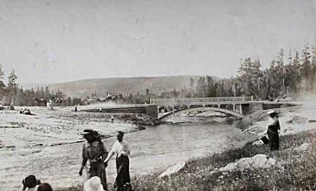
Gibbon River Bridge by old Wylie Camp
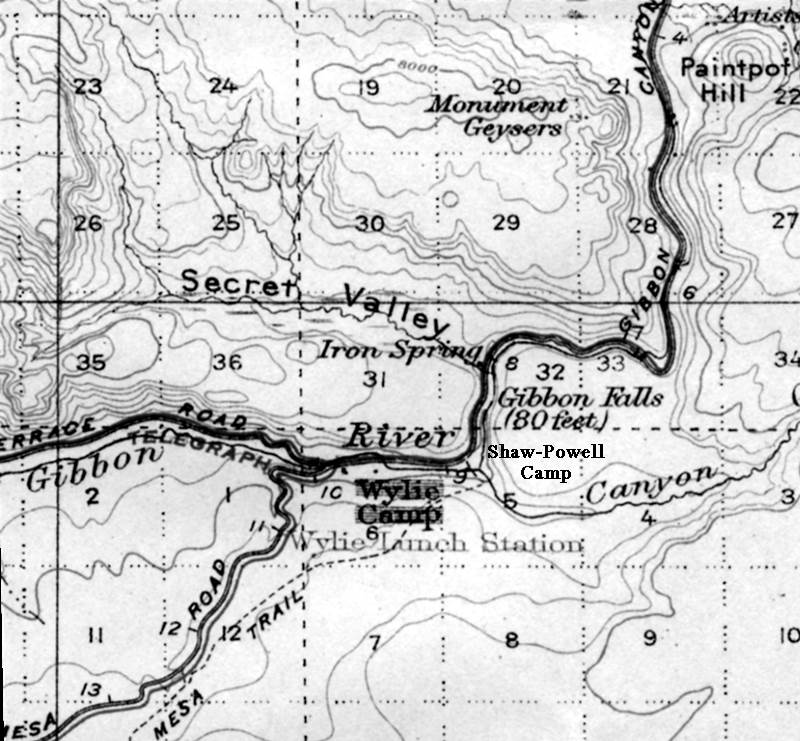
In 1894, a new road [Mesa Road] was completed from a point on the old road near Gibbon Canyon and below the Falls. It ran south across the plateau toward the Firehole River, and connecting with the main loop road at the exit of the Firehole Cascades scenic byway. A bridge was first erected at this site around 1901 just south of Gibbon Falls. A 1909 Bridge Report stated that Bridge No. 5 crossed the Gibbon River near the Wylie and Shaw & Powell camps, “The present structure consists of one pier in the middle of the stream, and two log abutments with log stringers spanning the space between. The bridge was built about eight years ago [ca1901] and is in a fair condition, but too light in construction for the travel it has to carry. It is recommended that it be replaced by a 40' steel plate girder span, resting on concrete abutments.”
|
 |
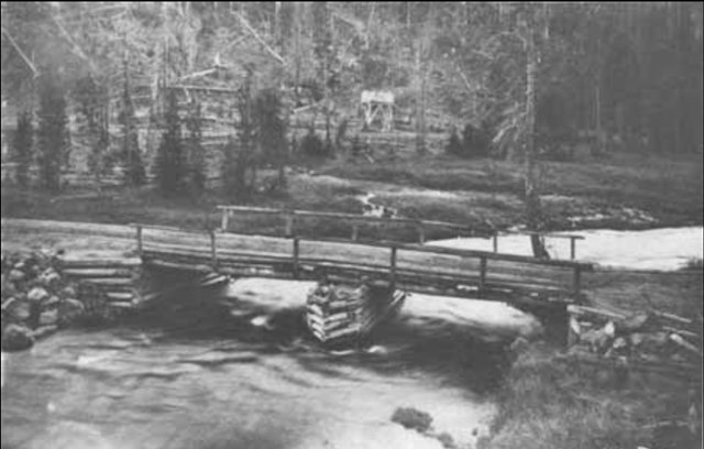
| 1914 Log Bridge. NPS Photo |
|
1912 Topo Map Excerpt, NPS |
|
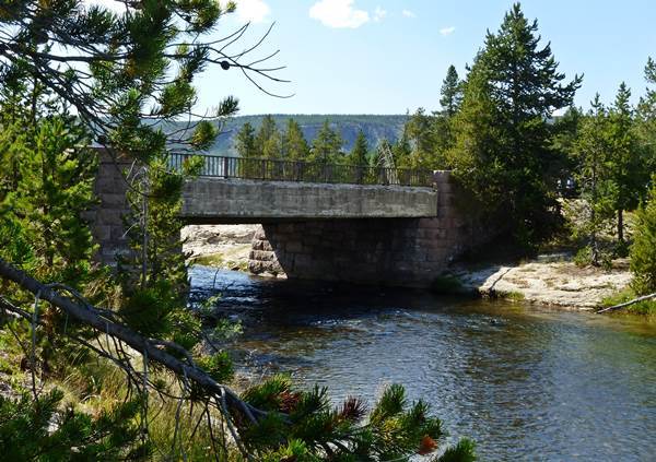
Based on recommendations in the 1909 Bridge Report, a 40' steel arch bridge was built over the Gibbon River in 1914 near the Wylie Camp, seventeen miles from the West Entrance.
In 1930, “realignment of the Norris Junction to Madison Junction road resulted in two steel bridges across the Gibbon River approximately 9 1/2 miles below Norris Junction being abandoned. It was proposed that both would be removed, however one bridge, which served the old stage road (Mesa Road) to the Firehole Cascades, was still needed as diverted traffic used this route while the new road was being completed.” At some point afterward the Mesa Road bridge (Bridge No. 5) was removed. As of 2008 traces of its existence still remained. [GRAND LOOP ROAD HAER No. WY-55]
2nd Gibbon Bridge. YNP Photo
|
 |
MAMMOTH - GARDINER – CORWIN SPRINGS
 |
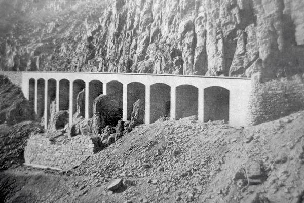
Golden Gate
In the narrow and beautiful rock-walled pass through which Glen Creek passes and along the steep walls of Golden Gate Canyon, Engineer Lt. Dan Kingman built a 228’ wooden trestle bridge in 1883. This new road up to Swan Lake Flats bypassed the treacherous Snow Pass road and was completed in 1885. Chittenden replaced the wooden structure in 1900-01 with a new concrete viaduct supported on concrete arches. The road was 16’ wide with a 42” parapet wall.
1885 Wood Trestle. NPS 1901 Concrete Bridge. NPS
|
 |
|
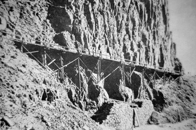
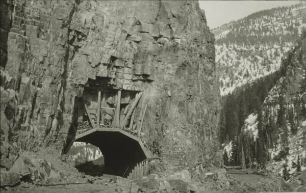
During the winter of 1932-33, an attempt was made to drive a tunnel through a protruding portion of the canyon walls. Close to completion in May of 1933, the tunnel caved in and all work on the project ceased. In 1933, the bridge was rebuilt and widened. The new 24’ wide viaduct had been built over the old bridge, however, it was independently supported.
Tunnel Construction 1932-33. NPS
|
 |
.jpg) |
The old structure was removed in the fall of 1976, and a new concrete bridge erected that was 30’ wide and 327’ long. The Pillar of Hercules, an iconic monolithic rock formation, was moved with each renovation and reset at the bridge entrance on a concrete platform.
Chittenden Bridge, 1970s. YNP #174626
|
Sheepeater Canyon Bridge - Gardner River
 |
Left: Sheepeater Cyn Bridge over Gardner River, ca1905.
Original negative, Copyright Robert V. Goss.
Right: Sheepeater Cyn Bridge over Gardner River, 1917. NPS photo.
|
 |
|
Around 1880, Supt. Norris had a crude road built from the main road just south of Camp Sheridan at Mammoth east to the Middle Gardner River and Sheepeater Canyon. There a small log bridge crossed the river and the road wound up the steep slopes of Bunsen Peak, past Ospey Falls, meeting up with the main road just above Rustic Falls. This is believed to be the 1st secondary road built in the park and remains today as a scenic hiking & biking byway.
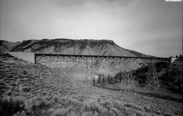
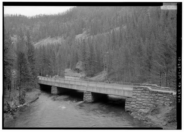
In 1903-04, the Sheepeater Canyon bridge was fabricated over the Gardiner River near the base of Bunsen Peak to access Tower Falls and Cooke City. Located located upstream of the current bridge site, it became the largest bridge in the park at that time. Consisting of five steel arch spans, 76’ each, and two approaches of 15’, the bridge totaled 410’ in length. The deck floor was about 70’ above the river surface. Traces of its approaches and old access road remain to this day.
|
Also known locally as the “High Bridge,” the new Gardner River bridge was completed in Nov. of 1939 at a cost around $247,000. At 205’ tall, it was the highest bridge in the park. It crossed the Gardner River just east of Mammoth along the road to Tower. It replaced the older and much lower bridge built in 1903-04, closer to the base of Bunsen Peak. There were 4 spans 184’ length with a total length of 962’ and a deck width of 28’. The decking was rebuilt and other repairs effected in 1978 under a contract with COP Construction of Billings, Montana for $888,293.
|
Sheepeater Cyn Bridge over Gardner River. Ca1960s, HAER
|
 |
!st vehicle bridge over the
Yellowstone River. Photo courtesy Yellowstone Gateway Museum |
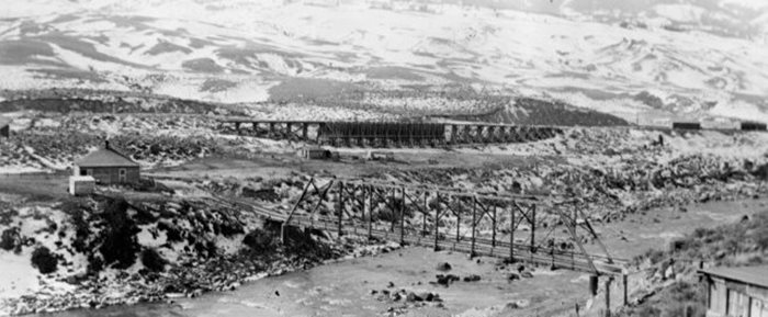
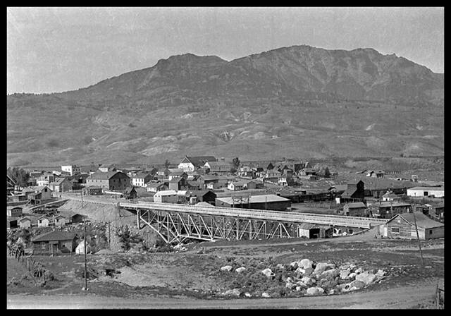
Gardiner Yellowstone River Bridge
A steel bridge was built over the Yellowstone River in Gardiner about a ½ mile below the current site in 1893 at a cost of $10,700.
In 1930, a new concrete bridge was erected over the Yellowstone River at the present site at a cost of $57,000. To commemorate the opening, a community dance and picnic was held on the bridge. Located near the old jail, the structure had a total length of 409’ with the longest span 192’. The roadway width between curbs was 38’ with a total width of 50’. It was rebuilt and widened in 1975.
|
2nd Yellowstone River Bridge.
Photo Coutesy HAER
|
|
Gardiner Swinging Bridge
In 1914, a swinging foot bridge was built over the Yellowstone River and remained in use until April of 1930 when construction of the new bridge began. It was located near the location of the current bridge and provided pedestrian access to the growing developments on the north side of the river.
YNP Photo #37086
|
|
|
Two young ladies from Denton, Texas described the Swinging Bridge in Gardiner in 1915 while preparing to join a Yellowstone Park tour with the Shaw & Powell Camping Co.: “We are warmly greeted at the hotel and enjoy our stay overnight. The following morning we walk over the village, and one interesting place we visit is an extension bridge over the Gardner river. It is built for pedestrians and is said to hold up to four people, but wait until you walk out to the center, where the bridge swings up and down with each step, while the rushing, foaming water beneath roars until you do not know whether you are going up or down; then you think it will not hold one.” [Denton Record-Chronicle (Texas) Aug 12 1915]
|
|
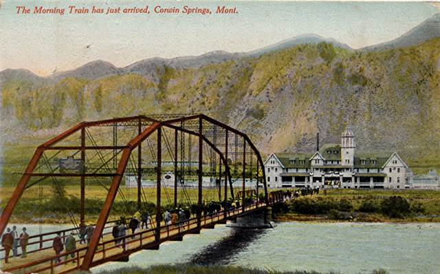
Corwin Springs Bridge
The Corwin Springs hotel was built on the east side of the Yellowstone River about 7-1/2 miles north of Gardiner in 1909 by the Electric Hotel Co. The bridge was built at the same time with Park County and the Hotel Co. splitting the $13,500 cost. Northern Pacific Railway trains from Livingston enroute to Yellowstone stopped at Corwin Springs and guests could walk across the bridge to the hotel. The length of the longest span was 216’ with a total length of 294’. The deck was 17.4’ wide with a clearance of 14.5’.
The hotel featured 72 rooms, a large swimming pool, private plunges, and Spray, Needle, and Shower baths that were fed with hot water piped in from LaDuke Springs.
|
Corwin Springs Hotel & Bridge postcard. Author's Collection
|
|
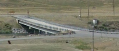
This historic and picturesque bridge was ignobly removed and replaced with a rather mundane-looking concrete structure in 2008. The new bridge, a 3-span, prestressed concrete structure, measures 294’ in total length, with a 30’ roadway and 32.5’ wide deck.
|
Corwin Yellowstone River bridge ca2015
|
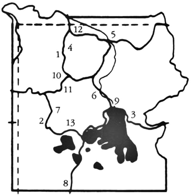
Honorable Mentions
The numbers are reference locations on the map below.
Numbers 9 & 12 are Fishing Bridge & Gardiner River Bridges, discussed earlier on this page.
All photos courtesy Historic American Buildings Survey (HABS) 1989
|
 |
 |
 |
01. Obsidian Creek Bridge
Indian Creek Campground road.
Built in 1910, it is a 1-span steel girder bridge w/4 transverse steel floor beams framing into the two main girders, with total length of 38'. |
02. Firehole River Bridge
Fountain Freight Road/Midway Geyser
Built in 1911, it is a 67' steel Pratt pony truss w/concrete abutments. Deck width is 16'. There are 5 panels of 13'-3", except for the middle panel which is 13'-6".
|
03. Cub Creek Bridge
East Entrance road.
Built 1928. It is a one-span concrete arch w/earth filled spandrels & stone masonry veneer, max length 20'. Deck width is
28'-5" & deck material is concrete with an asphalt covering.
|
 |
 |
 |
04. Seven-Mile Bridge
MHS to Norris Jct road.
Built 1932. A concrete girder bridge w/masonry piers & abutments, 3 spans with max span length of 27'. The flanking
spans are 23' & 25', respectively.
Deck width is 27'. |
05. Tower Creek Bridge
near Tower Falls.
Built 1933. The bridge is a 40' reinforced-concrete arch span, w/110' spandrel walls, faced w/stones. The roadway
width is 30' w/a 3' sidewalk on either side.
|
06. Otter Creek Bridge
south of Canyon Junction.
Built 1934. This is an arched concrete deck girder type w/concrete abutments. The one-span bridge is 68' from the ends of wing
walls. The deck width is 33'.
|
 |
 |
 |
07. Nez Creek Bridge
Madison Jct to Old Faithful road.
Built 1935. The bridge is a 3-span concrete deck girder type w/continuous slab & masonry piers/abutments. There are 2 spans of 25'-3" and one span of 28'. The deck width is 27'.
|
08. Crawfish Creek Bridge
1.5mi north of South Entrance road.
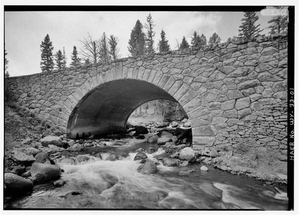
Built 1936, it is a 72', concrete, 3-centered arch bridge, w/a width between curbs of 24'. The structure length is 140'.
There is a 15' rise of the arch above the spring line.
|
10. Gibbon River Bridge #1
Norris Jct to Madison Jct road.
Built 1938. The bridge is a steel, I-beam continuous girder type, w/spans of 35', 40', & 35', constructed on stone masonry abutments & piers, w/reinforced-concrete deck. The structure's length is 110' and deck width is 29'-2". |
|
13. Isa Lake Bridge
Old Faithful to West Thumb road.
Built in 1942, a 8-span timber & log bridge w/maximum span length of 24'. 5 spans are 24' while 3 spans are 20'. The bridge
is 160' long & has a deck width of 28', curb-to-curb.
|
 |
Information for this
section courtesy,
"Yellowstone Roads and Bridges - A Glimpse of the Past."
NPS
|
Copyright 2017 by Robert V. Goss. All rights reserved. No part of this work may be reproduced
or utilized in any form by any means, electronic or mechanical, including photocopying, recording or by an
information storage and retrieval system without permission in writing from the author.
|
